
|
The Manx Northern Railway (MNR) commenced at St Johns and shared a station with
the Isle of Man Railway company's
Douglas-Peel
route. Looking west from the level crossing at the St John's station site
(currently a car park), double tracks at one time crossed here with the left
one being for Peel and the right being for Ramsey or Foxdale via the MNR. Note
also that the road is starting to climb to cross the
Foxdale branch
by a bridge to the right.
|

|
Over the crossing, a further current parking area was previously the site of
sidings and the junctions with the
Foxdale branch
.
|

|
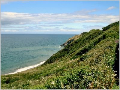
About 1/2 mile west, at the crossings of the River Neb, the two tracks, which
had run parallel since St John's, eventually separate. This photo is looking
east with the Douglas-Peel route on the right and the Ramsey route to the left.
Note that the Ramsey route is already climbing prior to crossing the nearby
Douglas-Peel (A1) road. Train racing was common to this point and several old
photos show this!
|

|
Immediately, the MNR shows a different character to the Peel line and this
extra elevation through a large part of the route is what made it so attractive
for sightseers. I've yet to walk the next couple of miles - which include the
demolished A1 road crossing and the still extant overbridge on the A20 - but
expect these at a later date.
|

|
The Ramsey Road out of Peel crosses the track at St Germaines. The next few
miles share the route with the Isle of Man
coastal path
.
|

|
Only a few yards along we reach the former St Germaines Halt - now a private
dwelling.
|

|
For the most part this was good walking - only spoilt in short sections by
excessive wetness! Sadly, rather than restore the old railway drainage - which
is presumably just blocked or damaged - the authorities have chosen to put in
new drainage chanels or piping which seems rather inappropriate somehow.
Anyway, here at Knocksharry we can take a look back toward Peel and St Patricks
Isle.
|

|
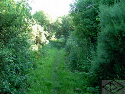
A straight, but rather damp, section of railway near Buggane Mooar.
|

|
Looking back at a fine preserved bridge near Ballanayre.
|

|
Looking forward at Ballanayre we enter a good cutting - which was unexpectedly
dry!
|
|
At the end of the cutting, this is Lady Port. Here a section of the trackbed
had obviously subsided/slid down the slope a few feet - but seems to have been
stable for a while now.
|

|
From the same point, looking back is another headland.
|

|
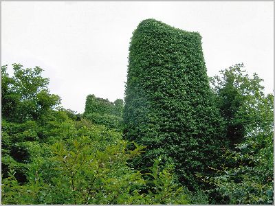
A little further on is this derelict linesman's hut.
|

|
Followed by this footbridge over a somewhat damp cutting - despite new drainage!
|

|
Still around Lady Port is this picturesque glen. The road is high up the valley
as we cross over a short embankment.
|

|
This is the view down to the sea from the same embankment.
|

|
Near LagDhoon we pass under the main road via what at first appears to be an
old bridge - surmounted by a girder bridge?
|

|
Looking back all becomes clear. Due to road widening/realignment the original
bridge has been superceded by an armco tunnel. Its a shame the opportunity
wasn't retained to keep this viable for any future railway restoration - of
which talk is occasionally heard.
|

|
Near Ballaquine we have to take a momentary detour down onto the road and up
the other side - because the bridge is gone!
|

|
Reaching Glen Mooar, the path takes another descent as we reach another missing
bridge. This was one of a number of trestle bridges (of which few photos exist)
which spanned the glen on the ivy-covered stone piers that are barely visible
here.
|
|
Viewed from below, it all becomes a little clearer.
|

|
What a fine site it must have been to have had trains up there!
|
|
The
coastal path
does not take this route but deviates to the beach whilst the
railway path continues northward - incidentally, rejoining the coastal path at
Glen Wyllin.
|
|
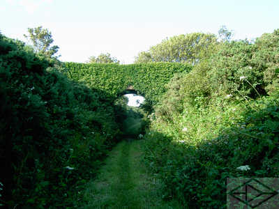
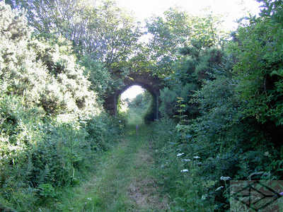
This fine ivy-covered bridge is on this section.
|
|
The last section of this track gets very narrow and damp before springing out
into Glen Wyllin and over another former girder bridge. The campsite shop has
some good old photographs of trains crossing there. Fantastic - almost not of
this country - more like some of the little railways in the north of India
somehow.
|

|
At Glen Wyllin, this is looking back in the direction of
Peel across the missing trestle bridge.
|

|
This is from the same vantage point looking down the glen to the sea.
|

|
This is also from the same point but looking to the north. Note the crossing
gates in the distance!
|

|
Arriving at the crossing gates we find there is only one. Just beyond is the
former Kirk Michael station - now the local fire station!
|

|
Also here is the sign which explains it all.
|

|
After leaving Kirk Michael Station, a good path continues along the old railway
track.
|

|
Looking back at the same point, the station buildings can be seen in the
distance.
|

|
Meanwhile, beneath the first overbridge, is a surprisingly complicated, and
picturesque, group of crossings and junctions.
|
|
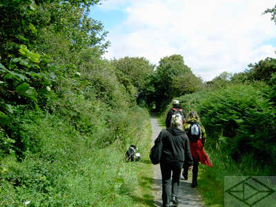
Continuing north, the railway keeps pleasant walking - and is popular with the
residents of adjacent Kirk Michael.
|
|
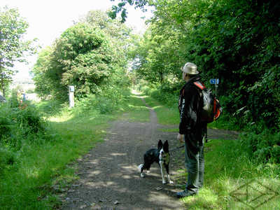
To the north of Kirk Michael, the
coastal path
leaves the railway route for the last time at
this footpath 'crossroads'.
|

|
Just north of Bishopscourt, the railway route goes over two former minor road
crossings. At the first is what appears to be an original crossing gate post
(inset).
|

|
The second Bishopscourt crossing. At both are well maintained former crossing
keeper's houses.
|

|
Just before Ballaugh, a small river crossing is used by both footpath and a
large pipeline.
|

|
On the Jurby road crossing in Ballaugh, the former goods warehouse (on the
left) was been restored by the Ballaugh Heritage Trust in 2014.
|

|
The goods warehouse was just part of significant railway infrastructure at
Ballaugh - of which this platform is another remnant.
|

|
Here at Ballavolley Halt was yet another level crossing. This sets the new
character of the railway route as the line crossed back across the island on
the way to the Ramsey terminus on the level of the northern plain, below the
mountains to the south.
|

|
After passing the Curraghs, the line reached Sulby Glen station. The original
station building has been extended slightly but the iroonwork for the station
canopy is still visible.
|

|
On reaching the centre of Sulby itself however, we have to make a detour here
to regain the route. Because...
|

|
...looking the other way there is no longer a path! I suspect one still
remains in theory, but it is long overgrown.
|

|
As elsewhere, the gate keeper's cottage has been adapted for new use. Note the
railway styled house number.
|

|
It is however only a short detour along the main Sulby straight to turn onto
the A17 and visit the former Sulby Bridge station in all its modernised glory.
|

|
Unfortunately again, there is no obvious way forward along the former trackbed
- although maps indicate a road track along here. In actual fact, access to the
route is very difficult between Sulby Bridge and the outskirts of Ramsey - with
only the occasional site of a level crossing available. This is very sad. There
is a good case surely for having at least a walkable path so that people can
have a traffic free route into Ramsey from the west?
|

|
So, after a number of detours, we can access the trackbed again. In fact, from
Gardners Lane/Bayr Yn Ghareyder the remainder is now walkable all the way into
Ramsey.
|

|
Once again we have our own green corridor - despite housing to either side.
|

|
At Gladstone Way (or is it Bircham Avenue?) there is even a pedestrian crossing
- although the trackbed was actually to the left of the distant trees behind
the lorry trailer and not the more obvious path behind the houses to the right.
|

|
Emerging at the other end of the road loop, this is almost the Ramsey station
site.
|

|
So this is looking up Station Road from the town end. The terminal station
previously stood on the current bakery site to the right behind the low wall.
|

|
At the north side of the bakery is an old wall. This may be the last remnant of
the original station works. However, although the station was the passenger
terminus, it wasn't the end of the line! A loop round from the north side of
the station continued across the road here and...
|

|
... ran all the way down the side of the harbour for transhipment between sea
and rail transport.
|